
Chasing Waterfalls in Clark Creek, Mississippi
I bet you didn't know that Mississippi had waterfalls. If you thought that waterfalls could only be found where there are mountains then, you would be like me, and we would both be wrong.
WHERE IS THE WATER?
Right along the Louisiana/Mississippi border there is an amazing trail system called Clark Creek state park. This park is located in Woodville Mississippi, just down the road from the Louisiana Tunica Hills WMA (wildlife management area). If you are in the area and feel like adding a few miles to your drive, go ahead and check out this hidden gem.
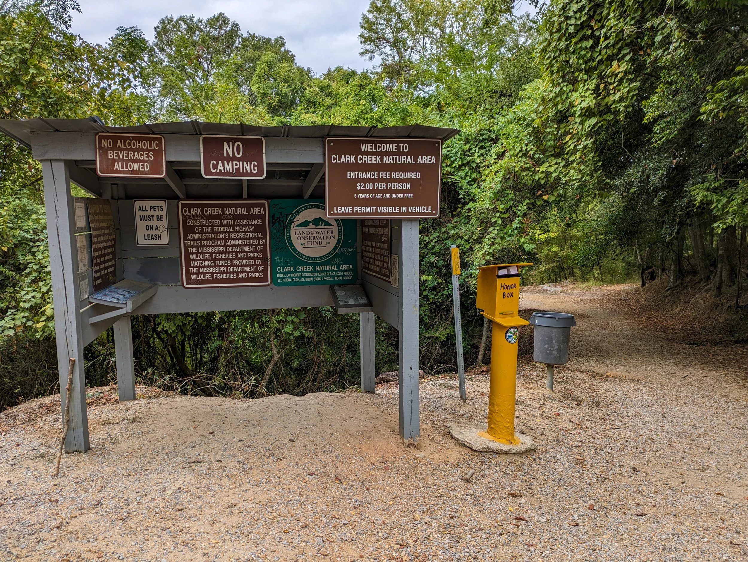
Small entrance station where you can see a map of the area and pay the entrance fee.
payment FIRST
The entrance fee of $2-3 per person is used to help maintain the area. Payment is collected via the honor system. Just past the restroom, you'll is the kiosk stand with a map of the area and a drop box. The drop box houses envelopes for cash payments and parking tags to hang in your vehicle's window.
While you could be sneaky, please, please please pay the entrance fee. It is such a reasonable price to keep the park beautiful and the trails safe. Don't risk bad karma, or unkept trails just to grab a tag without paying.
HOW IS THE TRAIL?
Once in the park, you have two main ways to go about exploring. There is a wide gravel trail that is very well maintained. This trail has several side paths that will lead you to the various waterfalls around the park, but it has a lot of hills and first timers will need a map. The trail that I prefer to take is the less maintained “primitive” trail and river path. This trial will actually let you walk through the water and follow the flowing streams. It leads to the top and base of the first few waterfalls. It can be a little difficult to find the first time, but that's what makes Clark Creek such an amazing place to revisit.

Gravel path leading down to the waterfalls
Overall the park has 7 waterfalls. I have only been to 5 of them so far. The first three waterfalls are “The Main 3”. They are the quickest and the easiest to reach. Most people that go to Clark Creek will only see The Main 3 before they head home. The map shows that the primitive trails will take you much farther into Clark Creek, but unless you started on the primitive trail, it's a bit difficult to find. The Main 3 will most likely be your focus on your first trip and that's okay. Take your time and feel free to explore at your own pace.


I will point out that the primitive trail is indeed primitive. The only real maintenance along the trail is the passing of feet so be prepared from some climbing, some ducking and a lot of bugs.
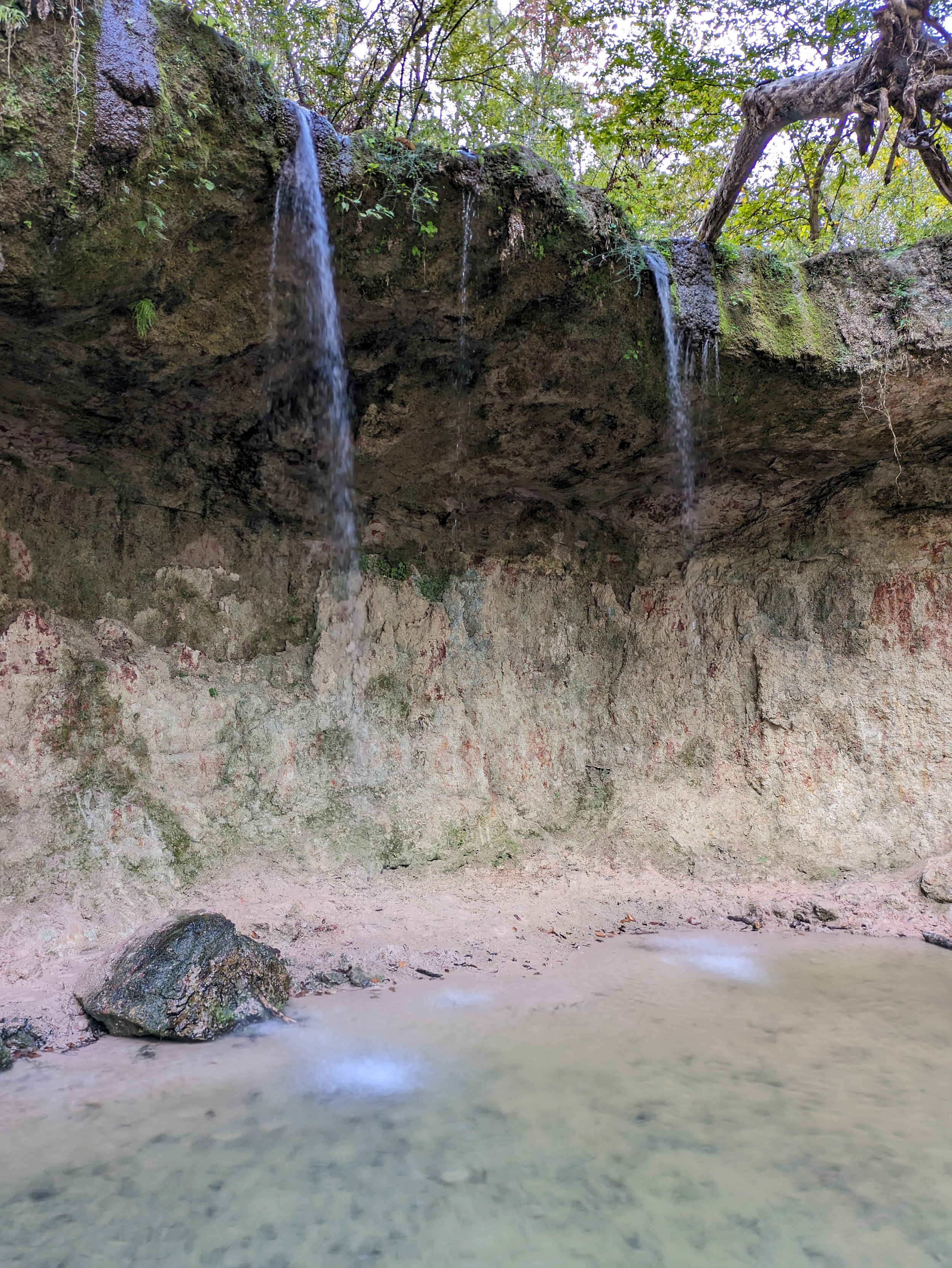
If it hasn't rained recently, the first waterfall you meet is not that impressive, but it does have a ledge that you can scramble behind for an Instagram worthy picture. Once you see the first waterfall feel free to follow the stream to the next waterfall because if you indeed take this path you will be on top of said waterfall. If you are bold enough, feel free to peer over, and watch water plummet a good 10-12 feet down before continuing down stream. Be safe, be smart, and don't jump.

Looking up to the top of a waterfall is always fun
To your right there is a convenient set of stairs so you can make your way down safely. Again, feel free to follow the water to the next stop. The stream will lead you, past boulders, to a fork with a sign. This landmark offers you a well worn map and informs you that the last of The Main 3 is to the left. This direction will basically send you to a dead end where a waterfall is waiting to greet you upon arrival. The final waterfall opens up to a large pool of water. Normally the water is not too deep and the spot provides a great picnic area to rest up, eat, and play in the water before heading out again. This is a forewarning, the water is cold.

View of the 2nd Waterfall from the bottom of the fall
It is also important to note that the landscape changes with the amount of waterfall the area receives each year. The first time my wife and I visited, the south had received about 5 hurricanes of various strengths, which meant that the water level at the park was fairly high. It was an awesome experience to climb over various rocks, and wade through the stream not knowing how deep the water would be.
My wife and I have gone back quite a few times and each time the landscape looks just a little different.


The main drawback of the park is its hilly terrain. Walking down into the park is fine but walking back uphill to your vehicle after a day full of hiking and enjoying the water… not fun. Another small downside of the park is that all 7 waterfalls are not connected to each other along a single loop. So if you want to see all of them on a single trip, it will require a few lengthy double backs.

A long staircase awaits to help you climb back to the top by the parking lot.
Again, we recommend checking out this place. Be ready for the downs and up because let's face anyone from Louisiana will not be used to many (if any) elevation changes on a hike. I look forward to seeing the last few waterfalls at the back of this park as much as I look forward to finding a new path to hike!
TRAIL REVIEW
DIFFICULTY: 7 OF 10
It is not a particularly difficult trail when you are following the water. Once you get back on the main trail the ups and downs in elevation definitely tire me out quickly.
ABILITY TO FIND: 6 OF 10
The trails are not near any main highway so it would be wise to download and save the route beforehand.
ENJOYMENT: 8 OF 10
I love any trail that has water near it much less a trail that lets you follow the water though-out. It does lose a few marks because the bugs can get pretty bad a times.
FACILITIES
Bathroom at the very start (top) of the trail.